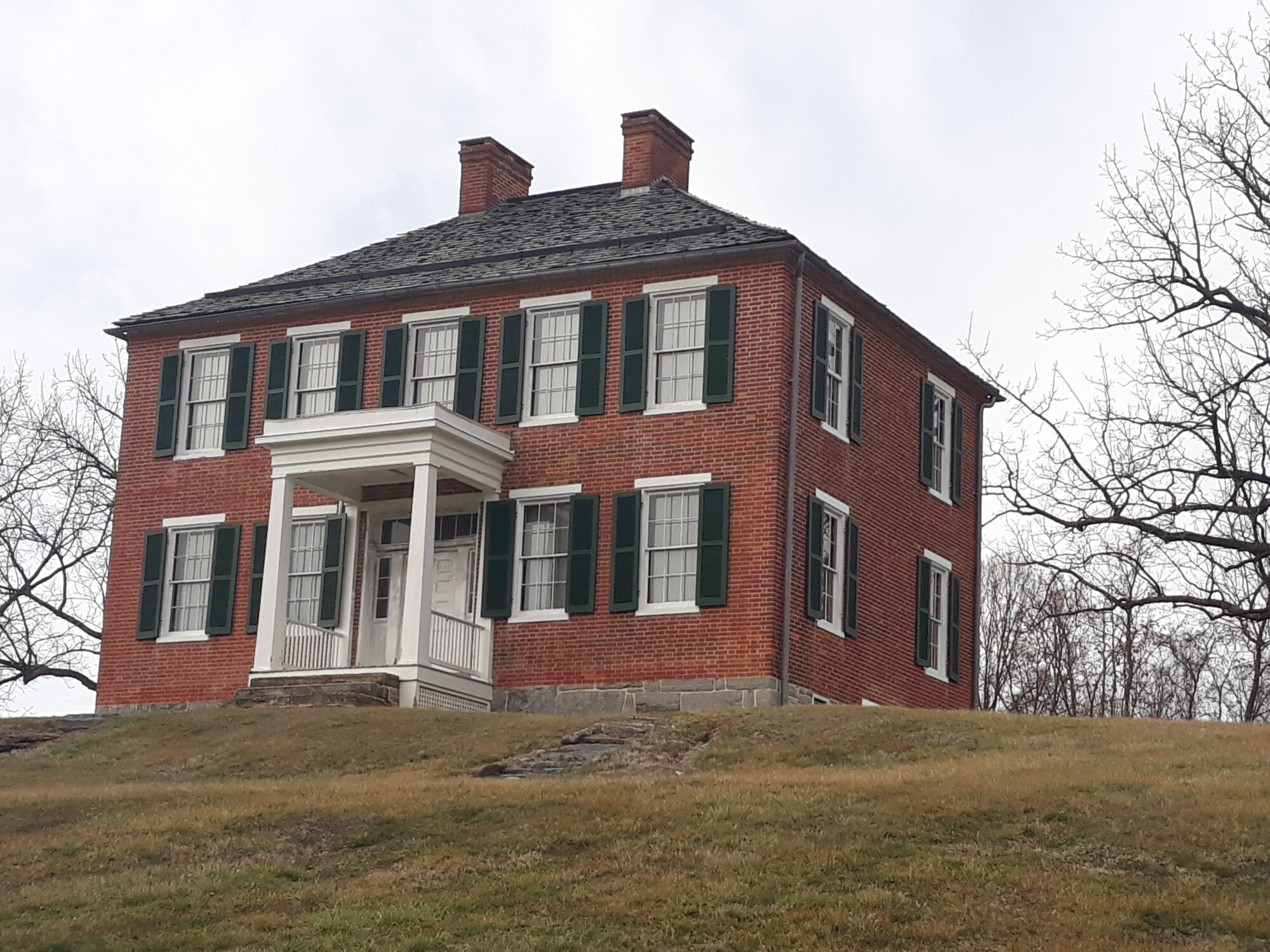
The Pry House built in 1844
As discussed in early Farmstead blogs, Joseph Chapline had been acquiring hundreds of acres of land along the Potomac River through grants and purchases. After the French and Indian War ended, Chapline was rewarded for his contributions and service. Maryland Governor Horatio Sharpe granted Chapline over 10,000 acres adjacent to his existing estate in 1763. Joseph Chapline was one of the largest landholders west of Frederick town with more than 15,000 acres, or 24 square miles in the Antietam Valley,
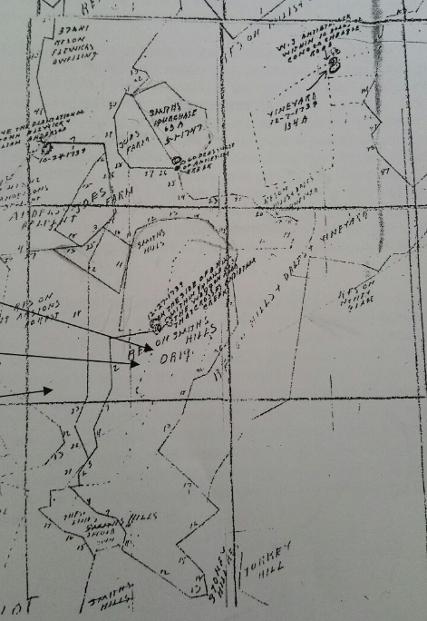
Map of the early land tracts including “Resurvey of Hills and Dales and Vineyard”
Joseph Chapline died on January 8, 1769, and in his Last Will and Testament, the huge estate was divided among Joseph’s nine children. A large portion of the tract of land known as the Resurvey of Hills and Dales and Vineyard lay to the east of the Antietam Creek. Several of the children sold parts of the land tracts that they received and Abraham Baker purchased 140 acres of the Resurvey of Hills and Dales and Vineyard tract on March 18, 1812. Just over a month later on April 26, 1812 Baker sold 126 3/4 acres of the property to Philip Pry, Sr., a relative newcomer to Washington County.
Philip’s father was a German-born immigrant of Huguenot descent named John DeBrie. John immigrated to colonial America with his siblings and mother as an indentured servant when he was six years old. Unfortunately, John’s mother died on the voyage across the Atlantic. In New York, John served out his indenture and was raised by a gentleman named Mr. Rohrer. On his twenty-first birthday, John was given a horse and he moved to Pennsylvania. Once there he changed his last name from DeBrie to either Bryen or Bryan and later to Bry. John married and in 1760 had a son, Philip.
Philip’s first wife, Anna Elizabeth died early in their marriage leaving no children. His second wife Susannah would bear him three children: Samuel (1814), Susannah (1815) and Philip, Jr. (1817). Philip arrived in Washington County, Maryland in 1810. It was here that Philip changed his name to Pry, purchased the property from Abraham Baker, started farming and began his family. Philip Sr. most likely farmed his lands until his death on May 1, 1823. He was buried in Fairview Cemetery in Keedysville. According to his will, he left this land to his wife, Susannah to manage. When Philip Jr., who was six years old at the time, reached the age of twenty-one the estate would be divided between the two sons – Philip and Samuel.
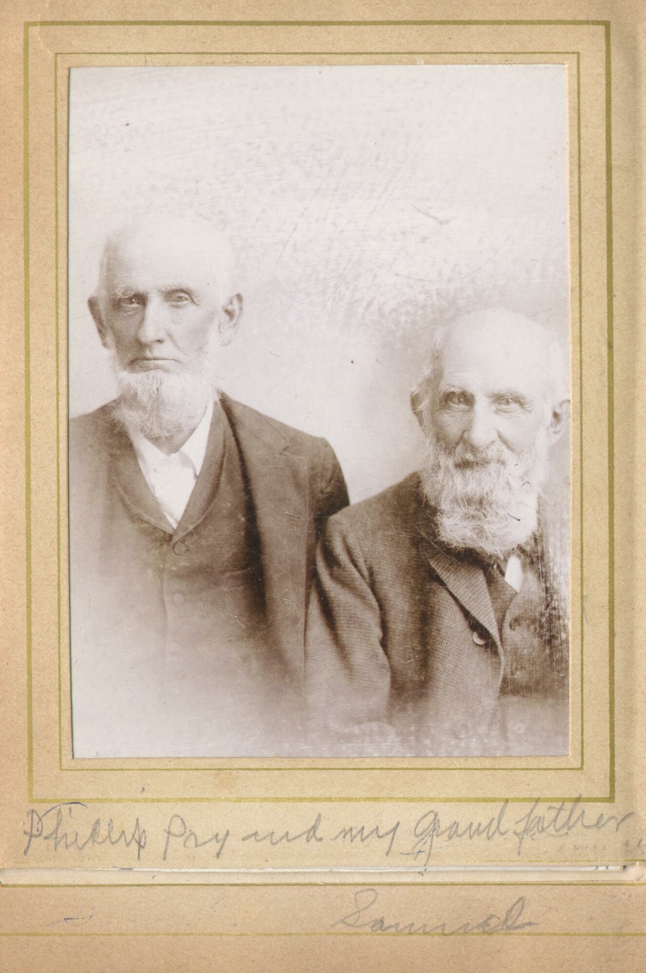
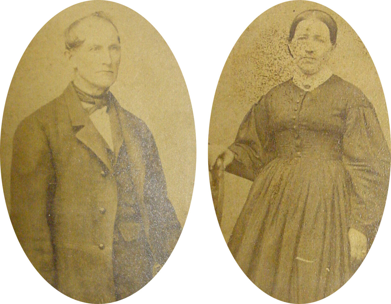
Philip and Samuel Pry
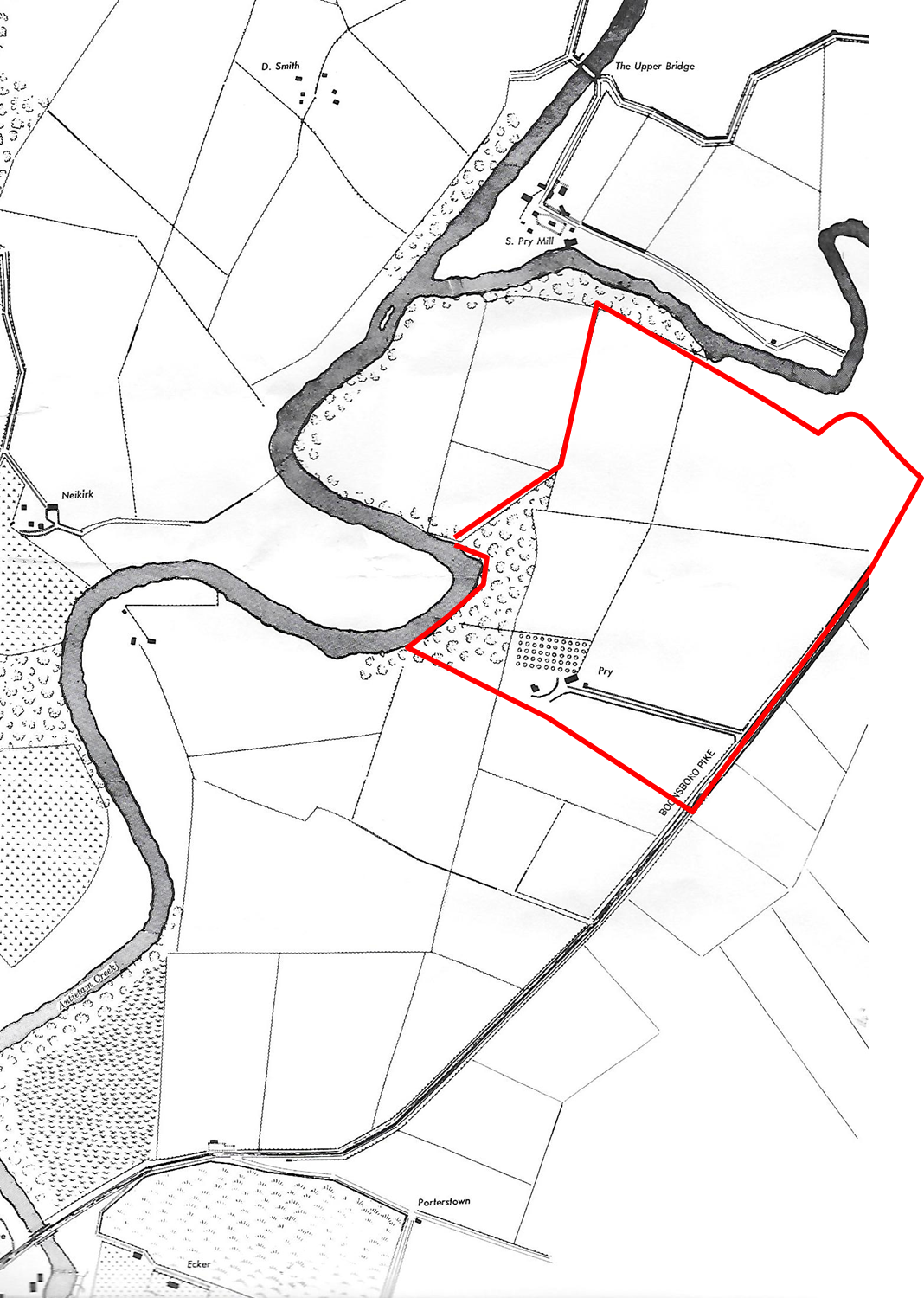
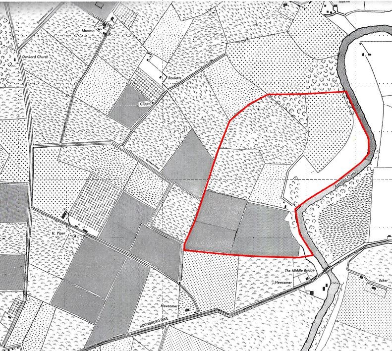
Approximate boundary of Pry Farm
Philip and his brother Samuel would continue to add land to their family holdings. In April 1839, the Pry brothers purchased an eighteen acre parcel of land from the tract of Resurvey of the Hill and Dales and the Vineyards owned by Catherine Hershey. According to the land records, this was “adjoining the lands owned ‘by the heirs of Philip Pry deceased'”.
It is unknown if this addition included the rise of high ground just east of the Antietam Creek with a commanding view to the west, but it is on this crest where Philip and Samuel would build a two-story brick house in the summer of 1844. This Greek Revival architectural style was very popular at the time. The bricks were manufactured on site and Philip carved his name and date on two of them, one on each side of the main entrance.
The Pry House
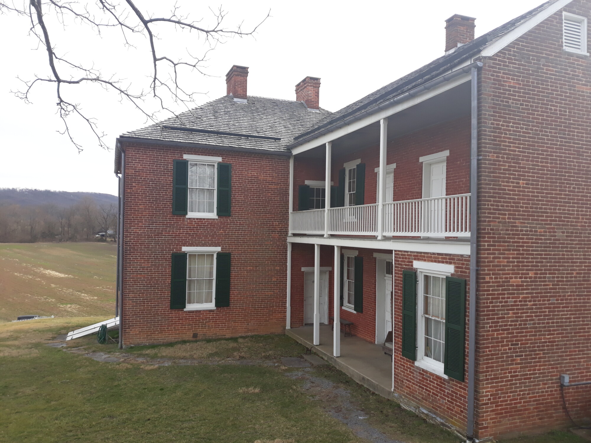
Back ell of the house
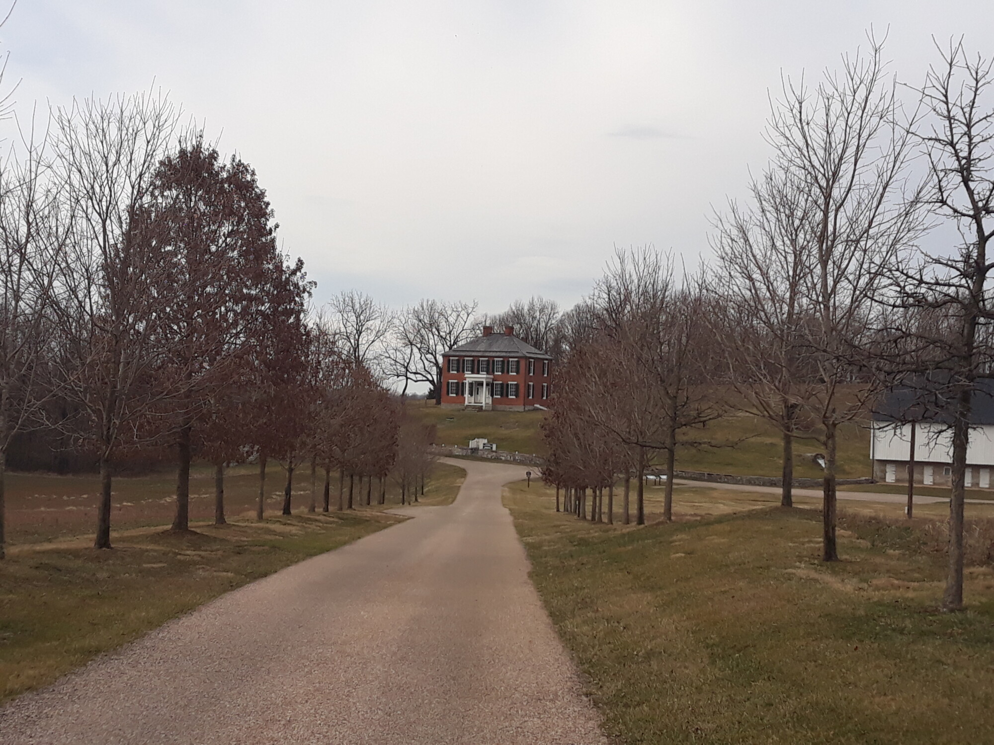
Tree lined drive
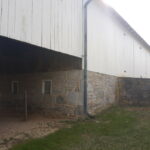
Once the house was completed a large bank barn was constructed just down the hill from the house with stalls, feeding mangers, and “run ins” to manage the livestock on the lower level. The upper level was used to process field crops and storehouses for fodder and grain. A spring was just off to the side of the barn.
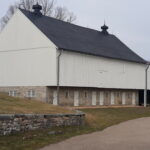
Bank barn
Wagon shed and corn crib
Spring
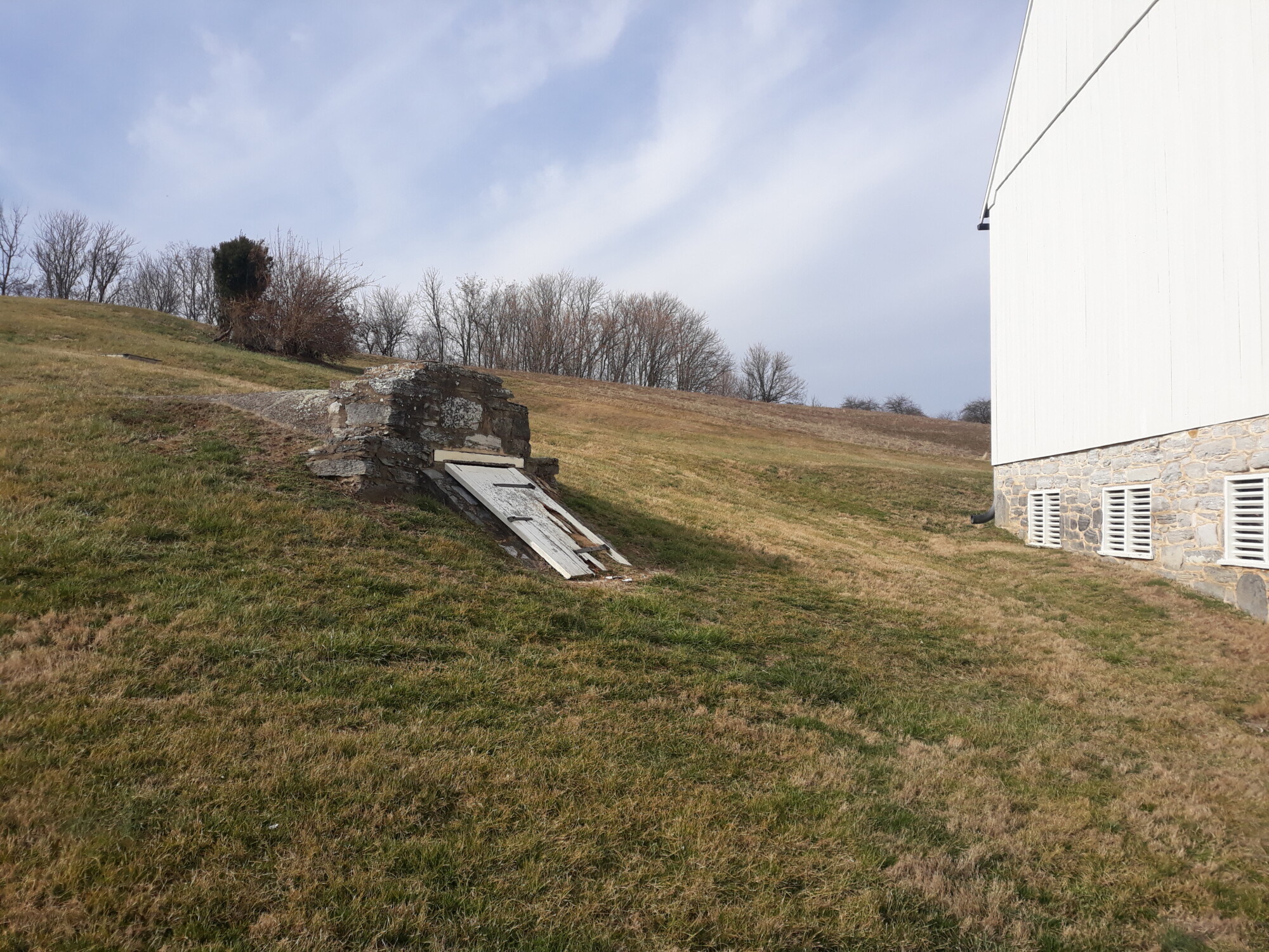
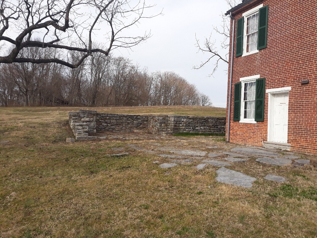
Just to the west side of the house was the kitchen and domestic building. To the front of the house at the bottom of the slope stood a few stone buildings and the root cellar.
Kitchen ruins
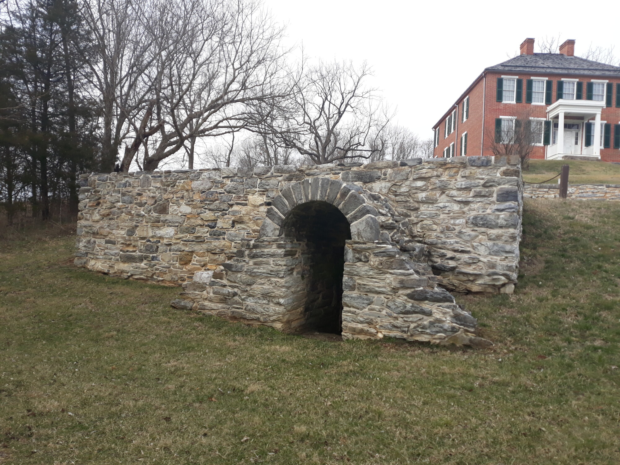
Root cellar

site of stone buildings
Samuel and Barbara Keedy Cost, a prominent Keedysville family were good friends of the Prys. Samuel was a lifelong resident of the area, a successful shoemaker and farmer, and would amass a farm of more than 450 acres. Samuel and Barbara had six children and two of their daughters – Mary Ann and Elizabeth Ellen, would eventually marry the Pry brothers.
Philip and Elizabeth Pry
On December 17, 1844 Mary Ann and Samuel would be married and have seven children. Just three years later on December 2, 1847, Elizabeth Ellen and Philip were also married and had seven children, five by the time of the battle: Samuel Cost (1848), Alfred Luther (1850), Ellen Elizabeth (1853), Jacob Alexander (1857), Charles Webster (1859), Annie Deaner (1861) and Mary Elizabeth (1866). All but Ellen Elizabeth survived to adulthood.
The Pry Mill
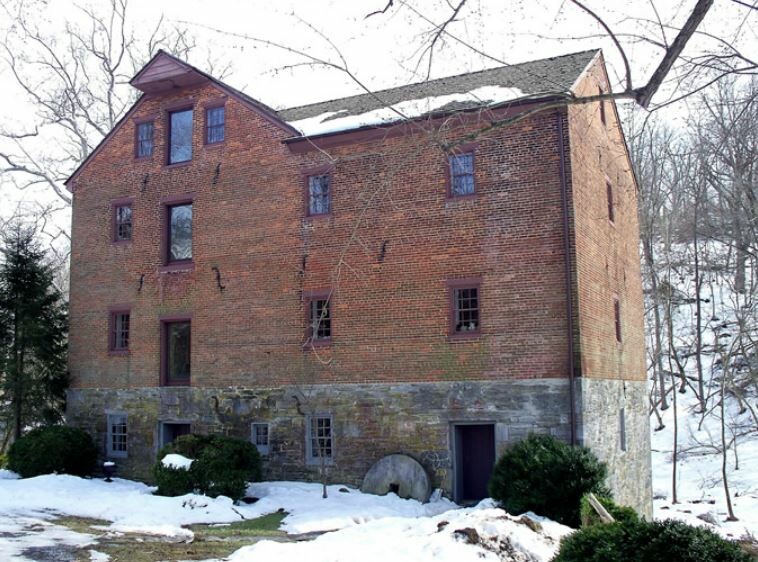
Just a year earlier, the property along the Little Antietam and the Antietam Creek, adjacent to the the Pry’s was subdivided into a 20.25 acre tract (with the Hitt mill) and a 130 acre tract (Hitt farm). Mary Ann and Elizabeth Ellen’s older brother, Jacob Cost would purchase the 130 acre farm and on December 17, 1847, Samuel and Philip Pry purchased the mill property. Samuel Pry would become the sole proprietor of the mill in 1850 and rebuilt the two-story stone mill with brick, and the mill assumed the shape it still has today . The first two levels are the coursed stone of the original mill. The mill property would remain in the Pry family until 1941 although milling operations ceased in 1926.
Location of the “Bunker Hill Farm” that Philip Pry purchased
The Pry and the Cost families were members of the Reformed Church and very active in the congregation of the Mount Vernon German Reformed Church of Keedysville. As the Pry’s raised their families, the farm and the grist mill prospered in the years prior to 1860. According to the 1860 census, Philip’s farm was valued at $14,000 with another $1,800 in personal property. Samuel’s mill was listed at $12,000 with $1,500 in personal property. In 1861, Philip purchased more than 160 acres from Samuel Mumma, what he called “lower farm”, for $10,500. Phillip renamed the 166 acre property the “Bunker Hill Farm”. Phillip and his family continued to live at their farm just across the Antietam but rented the Bunker Hill Farm to a tenant named Joseph Parks. (Learn about the Joseph Parks Farm)
Philip had his two older boys to help with the work around the farm, but he also hired a farm hand that lived with them, 22 year old William Gitmaker. It is unclear whether or not the Pry’s owned any slaves in 1860 but two African-American women lived in the household—Amanda Samper, age twenty, and Georgiana Rollins, age twelve. Amanda served as the house keeper and Georgianna served as a domestic servant.
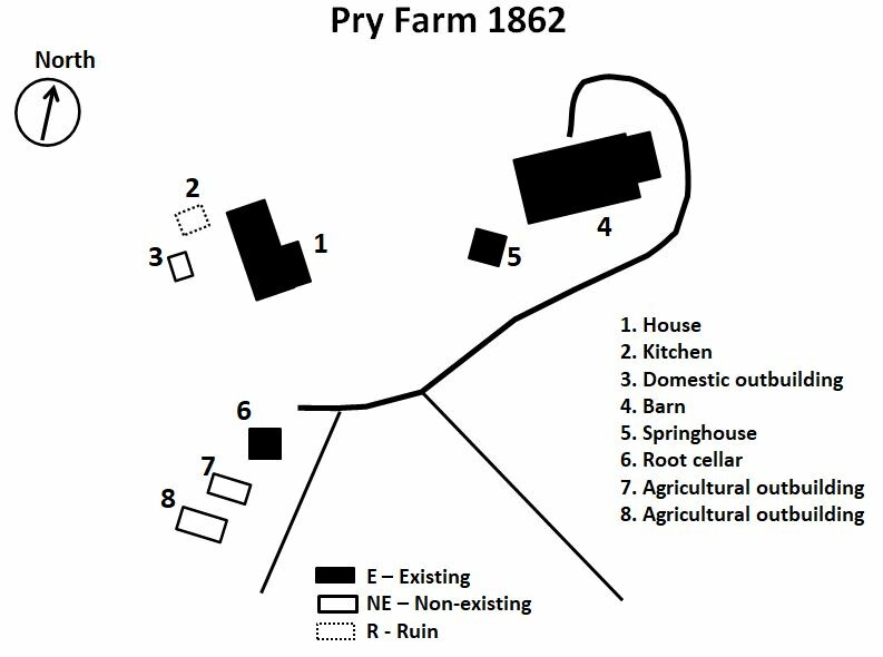
Layout of the Philip Pry farm in 1862
Like many of the local families in the Antietam Valley, they began to gather at their places of worship on Sunday morning, September 14, 1862. Just a few miles away on South Mountain, the Confederate Army clashed with Union forces moving west from Frederick. Throughout the day and into the early evening the battle raged. Despite the Confederates attempt to hold the mountain passes, General Robert E. Lee’s army suffered heavy losses and was forced to withdraw back toward the Potomac River. Wagons of wounded men moved down the Keedysville Pike past the Pry Farm heading to Shepherdstown, VA while the remainder of Lee’s army would hold up just across the Antietam Creek at Sharpsburg along the cemetery ridge.
The next day on September 15, the Union army under Major General George B. McClellan pursued the rebel rear guard through Boonsboro and Keedysville to the Antietam Creek. There the Federals began to converge along the Keedysville Pike. As it was getting too late in the day to begin any advance across the creek the Union Second Corp under Major General Edwin V. Sumner went into camp around the Pry farm.
The following morning a heavy fog blanketed the Antietam Valley as more Union troops and artillery took up positions along the east side of the Antietam. By mid-day the fog began to burn off and Confederate gunners on Cemetery Hill started to shell the Union forces. At the Pry farm, the family were in the middle of their daily chores when according to family lore a young captain by the name of George Armstrong Custer knocked on their door. Captain Custer, being a staff officer on McClellan’s staff, informed them that their farm would serve as a forward command post for Gen. McClellan.
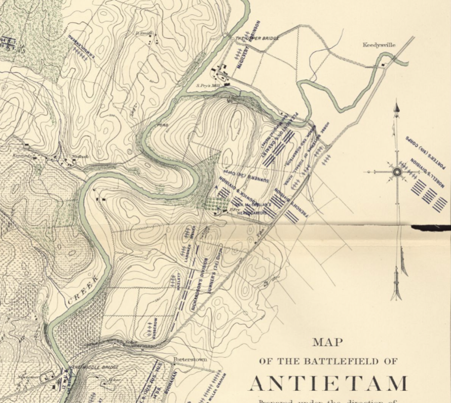
Battlefield map showing Union forces around the Pry farm
Soon the Pry farm became a hub of activity and a gathering place for Gen. McClellan, his staff and other officers. A system of signal stations had been established at Red Hill, the high peak on Elk Ridge and other locations across the Union line to observe the Confederate positions and movement on the west side of the Antietam. Couriers were continually riding in with reports and updates. Telescopes had been set up on the bluff by the house to observe the field. That afternoon, McClellan accompanied Major General Joseph Hooker and his First Corps as they crossed over the Antietam Creek at the Upper Bridge past Samuel Pry’s Mill and the Samuel Cost farm. Later that evening McClellan returned to the Pry house after ordering the Union Twelfth Corps, under Brigadier General Joseph Mansfield, to take the same route of march to support Hooker’s men. The stage had been set for the next days battle that would become the bloodiest single day in American history.
The battle began at daybreak on Wednesday, September 17 with some skirmishing in the East Woods that turned into a major engagement. Soon the artillery joined in from both sides. Gen. McClellan and his staff watched the opening salvos from the bluff as Hooker’s men moved south from the North Woods. Soon wounded officers and men began to arrive at the farm which was quickly being turned into a hospital. McClellan ordered an ambulance to take Mrs. Pry and the children to the home of Jacob Keedy near Keedysville. Philip Pry stayed at the farm during the entire battle. During the early morning fight a Mr. Rohrer from Keedysville was brought to the bluff ‘to plot smoke from artillery burst on a large map in the yard’. It is said that several times during the fighting McClellan went up to the attic to stand on a barrel out the trapdoor to look over the field from this vantage point.

Alexander Garner photo of the Pry House
Around 7:30am, McClellan gave orders to Gen. Sumner to move the Second Corps over the Antietam to join in the fight. Dr. J.H. Taylor, stayed behind to begin setting up hospitals not only at the Pry Farm but at the Cost Farm and Samuel Pry’s Mill. Gen. Hooker arrived with a wound to his foot that morning. He was treated in the parlor and taken to Keedysville. Soon the barn and outbuildings were filled with wounded soldiers and Union officers were being brought to the house. Major General Israel B. Richardson, a Second Corps division commander was severely wounded by a shell burst near the Sunken Road. Richardson was evacuated to the Pry Mill for initial treatment before taken to the Pry House. He was taken to the large bedroom on the second floor. “General McClellan sent Dr. Horace, a member of his staff, and Medical Director Dr. Jonathan Letterman to examine Richardson. Both men feared shrapnel had lodged in his left lung and deemed the wound mortal” Two weeks after the battle on October 2nd, during a visit to the battlefield, President Abraham Lincoln stopped at the Pry house to visit the wounded General Richardson. Under the care of Dr. Taylor and Richardson’s wife Fannie, he started to recover but tragically Richardson succumbed to his wounds and died in the upstairs room of the Pry house on November 3, 1862.
By night fall on September 17 the battle would be over but the wounded were still coming to the farm. An estimated 1,500 injured soldiers were cared for at the Pry farm. Gen. McClellan left that night to return to his headquarters west of Keedysville. On September 19, the Union army pursued Lee’s retreating army to the Potomac and the campaign would come to an end with a battle at the Shepherdstown Ford the following day. Like many, if not all the Pry’s neighbors and friends in the area, the war had come and gone but they were left with the remnants. Several weeks later when Dr. Elijah Harris of the U.S. Sanitary Commission came to inspect the hospital, he reported that 250 wounded and sick men were still receiving attention. The Pry farm would remain a hospital for at least two months. Their crops had been eaten, fields destroyed, and their fences were cut down for firewood.

Damage Claim submitted by Philip Pry
The Prys would do their best to recover after the battle but it almost ruined Philip Pry. According to Mr. Pry a board of appraiser would be around to appraise the value of the property used, but the army had moved on before the task could be completed. He had to wait until November 27, 1865 to receive his first payment in the amount of $2,662.50 for military damages.
When the claim was submitted, an agent came to investigate. They questioned several individuals loyalty to the Union during wartime and character witness were interviewed. “Jacob Cost, C. M. Keedy, Samuel Keedy, Alfred N. Cost, Ezra Lantz, F. Wyand, and David Bell testified that they were farmers and neighbors of the Prys. They reported visiting the Pry farm frequently in the fall of 1862, and personally knowing that Philip lost heavily.” Philip stated that Union horses consumed 900 bushels of wheat and twenty acres of corn, 85 acres of the farm was used as a pasture by the Union horses, and fifteen hundred feet of lumber had been taken to build Union hospitals. Phillip also sought rent for the use of his house as a hospital during and after the battle.
Two other claims were paid out seven years later in 1872 for a total amount of 1,581.03, a full decade after the Battle of Antietam. However there was a claim made by the government that this was an overpayment. Unfortunately, the government deemed part of this to be overpayment and Philip Pry was forced to repay $1,209.38. With this financial burden of overpayment, legal fees, and attempting to get the farm back into shape the Prys were forced to sell the farm and move to Tennessee in 1874.
Maryland Senator, William T. Hamilton, writing from the U. S. Senate Chamber on February 25, 1874, said of Philip Pry: “Before the war he was a prosperous man, owning one of- the finest farms in the county lying in the vicinity of the battlefield of Antietam. He is now in serious circumstances. I have known him for thirty years, an upright, honest man and good citizen. His loyalty is unquestioned”.
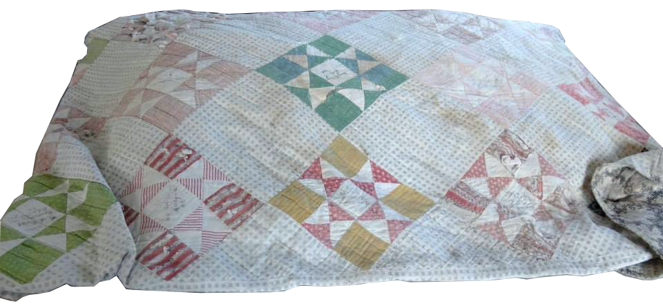
The Pry Memory Quilt
The farm was sold to Daniel W. Wyand of Washington County for the sum of $14,172.50 containing 141 ½ acres. Before departing for eastern Tennessee, friends and family in the community gathered and made a Memory Quilt as a parting gift. Many of the friends and neighbors that Elizabeth and Philip had known all their lives personalized a block of the quilt with their signatures or brief sentimental notes.

Elizabeth and Philip Pry’s gravesite at the Fairview Cemetery in Keedysville
The Prys lived near Johnson City, Tennessee until Elizabeth passed away on February 1, 1886. Upon her death, Elizabeth wished to return home to Keedysville, so Philip and their daughter Annie accompanied her remains back to Maryland to be buried next to her family at Fairview Cemetery in Keedysville. After the service, Philip stopped one last time to visit the home he had built over forty year before on that bluff overlooking the Antietam Creek. Annie’s daughter Elizabeth Jones wrote of this return visit, “As you enter the house to your left is a room then from that room you enter a room–that was where all the children were born. Mamma told me when she and her father visited the house he stopped in that room and cried“. Philip passed away on February 3, 1900 and was buried alongside his wife.
The farm changed hands eight times until January 31, 1956 when Leo B. and Vila M. Wyand purchased the farm and 123 acres from Victor and Ruth Stine. The Wyand’s continued to farm the property until 1971 when the land was resurveyed and a parcel of 155.68 acres was sold to Recreational Properties Associates. Three years later on March 7, 1974, the Recreational Properties Associates sold a tract of land containing two acres around the Pry house and barn to the United States Government with 24.67 acres scenic easement for $62,500.
In the fall of 1976 an electrical fire damaged part of the first and second floors. The National Park Service restored and renovated the structure. In 2005 the Park Service partnered with the National Civil War Medicine Museum to establish the Pry House Field Hospital Museum. Today the Pry House is one of the two farmsteads on the battlefield that are open to the public. Visitors to the Pry House Field Hospital Museum are able to explore the house, barn and grounds of the farm. Here they learn about the medical aspects of the battle and they hear the tragic story of the Pry family and how their farm became an eyewitness to history on September 17, 1862.
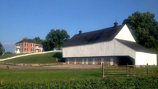
The Philip and Elizabeth Pry Farm today.
Sources:
- Barron, Lee and Barbara Barron, The History of Sharpsburg, Maryland: Founded by Joseph Chapline, 1763. Sharpsburg: self-published, 1972.
- Gardner, Alexander, Library of Congress Prints and Photographs Division, Selected Civil War Photographs Collection, Washington, D.C., 1862. Retrieved from http://www.loc.gov/pictures/related/?fi=name&q=Gardner%2C%20Alexander%2C%201821-1882
- The National Museum of Civil War Medicine, Pry House and Family History, Frederick MD. 2020. Retrieved from http://www.civilwarmed.org
- Washington County Historical Trust, Pry Mill, circa 1820, west of Keedysville, MD, Hagerston, MD 1998. Retrieved from http://washingtoncountyhistoricaltrust.org/pry-mill-circa-1820-west-of-keedysville-md
- Maryland Historical Trust, Hitt’s Mill Complex, WA-II-120, Maryland Inventory of Historic Properties Form, 1978, July 2003.
- Reardon, Carol and Tom Vossler, A Field Guide to Antietam: experiencing the battlefield through history, places and people, Chapel Hill: The University of North Carolina Press, 2016.
- Schildt, John W., Drums Along the Antietam. ParsonMcClain Printing Company, 2004.
- U.S. National Park Service, Antietam National Battlefield, National Register of Historic Place, ANTI-WA-II-477, Washington D.C.: Government Printing Office, 1990.
- U.S. National Park Service, Philip Pry House, Antietam National Battlefield, Historic Structures Report Washington D.C.: Government Printing Office, 2004.
- U.S. War Department, Atlas of the battlefield of Antietam, prepared under the direction of the Antietam Battlefield Board, lieut. col. Geo. W. Davis, U.S.A., president, gen. E.A. Carman, U.S.V., gen. H Heth, C.S.A. Surveyed by lieut. col. E.B. Cope, engineer, H.W. Mattern, assistant engineer, of the Gettysburg National Park. Drawn by Charles H. Ourand, 1899. Position of troops by gen. E. A. Carman. Published by authority of the Secretary of War, under the direction of the Chief of Engineers, U.S. Army, 1908.” Washington, Government Printing Office, 1908. Retrieved from https://www.loc.gov/resource/g3842am.gcw0248000/?sp=5.
- Walker, Kevin M and K. C. Kirkman, Antietam Farmsteads: A Guide to the Battlefield Landscape. Sharpsburg: Western Maryland Interpretive Association, 2010.
- Western Maryland Regional Library, The Illustrated Atlas of Washington County, Maryland was published in 1877. Lake, Griffing & Stevenson of Philadelphia, 1877. Retrieved from http://whilbr.org/Image.aspx?photo=wcia053s.jpg&idEntry=3497&title=Sharpsburg+-+District+No.+1
Leave A Comment